Interactive Night Map in Hackney
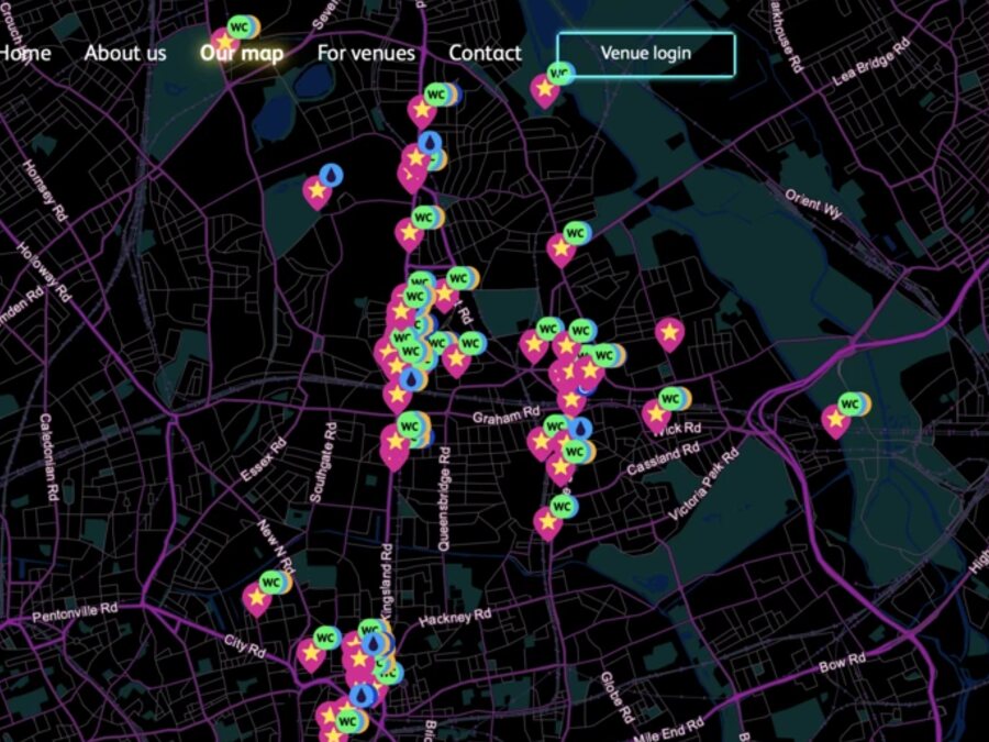
Hackney Council launches interactive map to locate toilets, charging points and more after dark.
Hackney Council has launched an interactive night map as part of the Hackney Nights campaign, offering real-time information on night-time services. The resource includes toilets, mobile phone charging points, drinking water and wheelchair-accessible routes.
The map features electronic music venues such as MOTH Club, Dalston Superstore, Night Tales, Colour Factory, The Glove That Fits and EarTH, and is accessible via QR codes on venue windows and keyrings, meeting safety and inclusivity standards.